
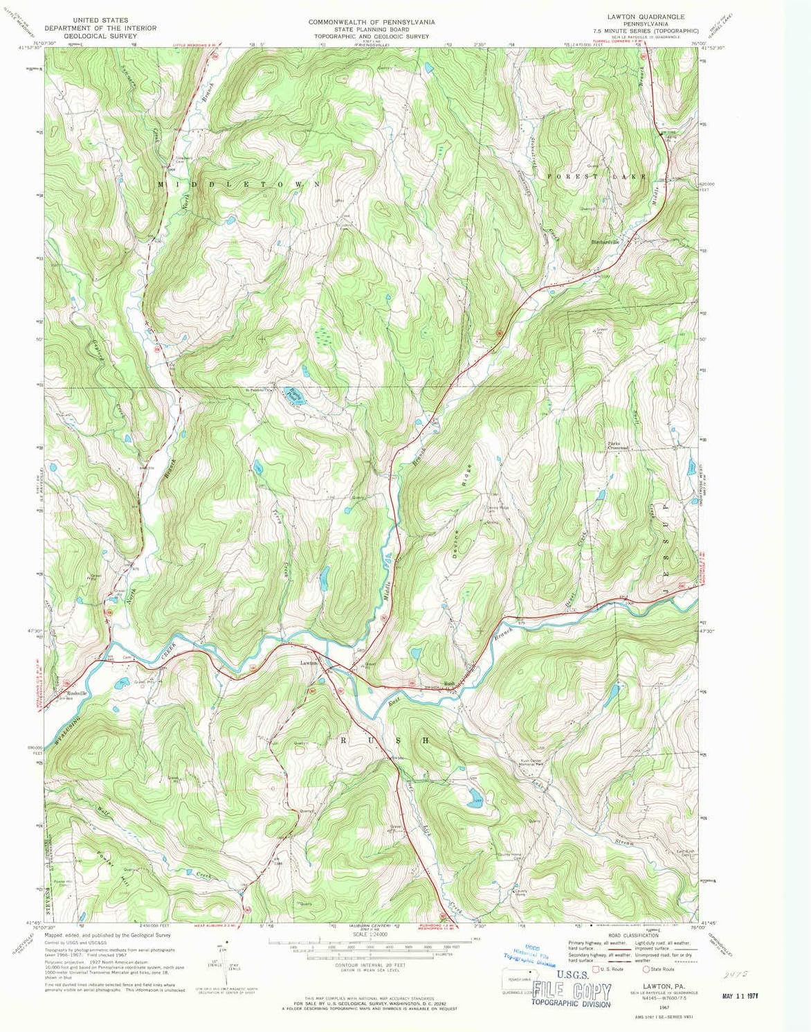
Lawton PA topo map, 1:24000 Scale, 7.5 X 7.5 Minute, Historical, 1967, Updated 1971, 27 x 22.1 in - Paper
US$19.98
Price when purchased online
Free shipping
Free 30-day returns
Sold and shipped by vdmeij.nl
We aim to show you accurate product information. Manufacturers, suppliers and others provide what you see here.
Product details
| Management number | 221640355 | Release Date | 2026/05/03 | List Price | US$19.98 | Model Number | 221640355 | ||
|---|---|---|---|---|---|---|---|---|---|
| Category | |||||||||
Printed on Regular Paper
- Printed on Regular Paper (32lb)
- USGS topographic map of Lawton, PA, at 1:24000 scale. High-quality paper print. Perfect for wall maps.
- Cities, towns, villages: Lawton,Rushville,Parks Crossroad,Rush,Birchardville
- Rivers, creeks: Middle Branch Wyalusing Creek,Snell Creek,Stonestreet Creek,North Branch Wyalusing Creek,East Branch Wyalusing Creek,Deer Lick Creek,Summers Creek,Deuel Creek,Elk Lake Stream,Terry Creek,Gaylord Creek
- Lakes: Rigsby Pond
| Color | Regular Paper |
|---|---|
| Map Type | Historical, Topographic |
| Brand Name | YellowMaps |
| Item Weight | 57 Grams |
| Part Number | USGS-5325190-PAPER |
| Manufacturer | USGS |
Bestseller ranking
Topographic Maps


Customers who viewed this product also viewed
Tables & Accessories


Correction of product information
If you notice any omissions or errors in the product information on this page, please use the correction request form below.
Correction Request Form